Posts

Moose Bog Trail - Wenlock WMA - Brunswick, VT

Image
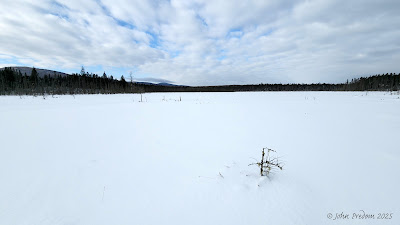
  The Moose Bog Trail is a 2.3 mile out and back with 20 feet of elevation gain, a section of it is considered an ADA trail. This is a popular birding area where Spruce Grouse, Canada Jay, and Black-backed Woodpecker are often seen. There is an extension to Rte 105 and a spur trail back to South America Pond Road that are included in this distance. A boardwalk and platform reach into the bog. Map and hike details : https://connect.garmin.com/modern/activity/2556025312

Damon Crossing to Stone Dam - Victory Basin - Victory, VT

Image
Did this hike with the Northeast Kingdom Section of the Green Mountain Club. Cathi Brooks led the hike, with a total of 5 attending. The trail is an out and back, a total distance of 3.4 miles, with 174 feet of elevation gain, a relatively flat hike. Much of the trail is not maintained. The snow was deep, but people had been through before us, except for the last half mile. There was orange ribbons that marked the trail when it got difficult to follow.      Map and hike details: https://connect.garmin.com/modern/activity/18224573365

Gore Trail to Gore Junction - Norton, VT

Image
The original intention of this hike was to go to Split Rock on the Middle Mountain Trail. The snow was so deep we were only able to get to Gore Junction at the Kingdom Heritage Trail. This hike was 2.5 miles out and back, with 434 feet of elevation gain.   Map and hike details: https://connect.garmin.com/modern/activity/18214752338

East Trail - Mt. Pisgah - Westmore, VT

Image
  East Trail - Mt. Pisgah, 4.5 miles out & back, 1141 elevation gain The Pisgah East Trail , (also known by some as the Long Pond Trail on Pisgah, which can easily be confused with the nearby Long Pond Trail on Bald) is a relatively easy hike on a not very well marked forest road, but to get to the summit you need to take a short steep section on the North Trail, which makes this a much more challenging hike. On this day I was able to wear micro-spikes and walk on top of the snow. At the first field opening be sure to turn right and continue following the forest road to the next opening. There is a sign in that field that points right again. Here you will continue following the forest road to a Y intersection where you will take a left to another sign which leads away from the forest road on a trail. This short section (0.3 miles) leads to the North Trail. From here is gets aggressively steeper and on icy days we have turned back. Within a short distance (maybe 0.2 miles) you a...

Adopting my First Trail(s) - The Unknown Pond / South Middle Mountain Trail - Norton, VT

Image
The Unknown Pond / South Middle Mountain Trail is 6.84 mile out and back with 1805 feet of elevation gain. I'm pretty excited! After years of hiking in Vermont and being a member of the Green Mountain Club I have adopted two trails " Unknown Pond Trail / South Middle Mountain Trail" that I will maintain. If you have ever hiked in Vermont there is a good chance it was on a trail that the GMC maintains. Bear Ledge Vista     When I first started maintaining this trail the Bear Ledge Vista was known, but there wasn't a trail to it.   The Unknown Pond Trail is 1.2 miles long and ends at the junction of the Kingdom Heritage Trail. From the junction it is 2.2 miles to the summit of Middle Mountain. Middle Junction Trout Lily's The volunteer duties include removing blowdowns in the Spring, after storms, and in the Fall. Blowdowns Blowdowns removed   Another task in the Spring and Fall is clearing drainage and waterbars.      

Spruce Mountain Hike

Image
A first hike with the NEK Section was with Bart Selle on Spruce Mountain in May of 2017. This hike is a 4.4 mile out and back, 1164 feet of elevation gain. Finally! It felt good to get back in the woods. This seems to be a popular hiking spot in Plainfield, Vt. I thought I might be hiking alone, but there was plenty of people on the trail and I met a fellow GMC'r at the trailhead and we hiked together for the whole hike. Bart Selle Near the summit Painted Trillium